All posts by tedleeeubanks
The Sandhills Journey Scenic Byway

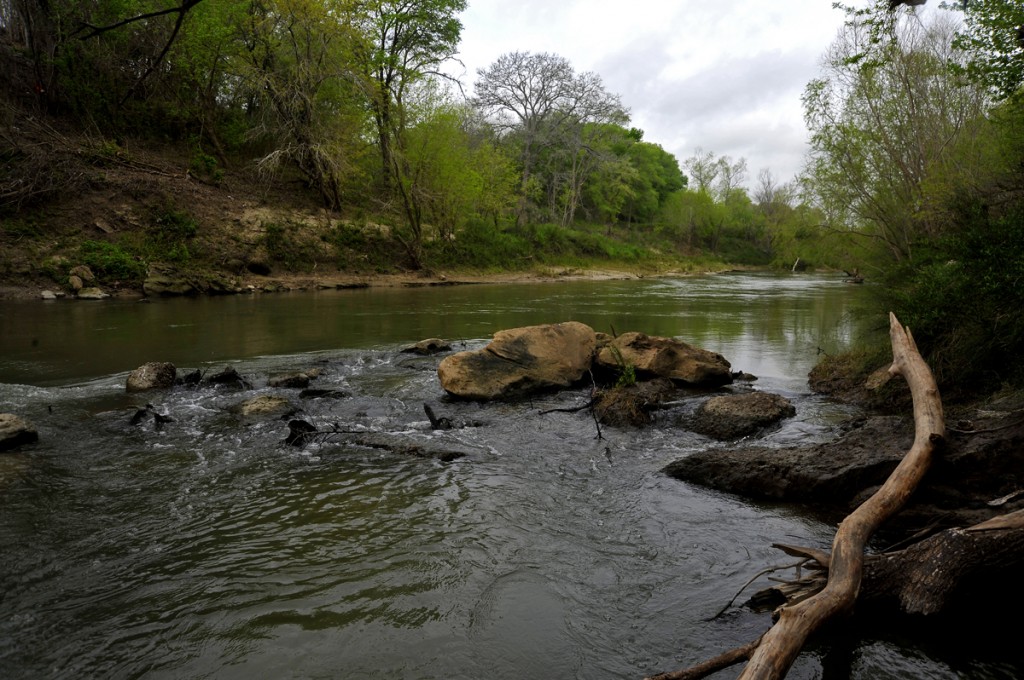
Ted’s San Antonio River Photo To Be Used In Witte Museum Exhibit

This exhibition focuses on excavated archaeological finds from the San Antonio River never before seen by the public, and explores the natural and cultural resources that sustained communities overtime. SARA is celebrating 75 years of overseeing the water resources of the San Antonio River coursing through Bexar County and the surrounding areas.
Be sure to take advantage of this unique opportunity! The photo is part of a collection from Fermata’s work with URS on a SARA watershed plan for the lower stretch of the river. Thanks to all (particularly Jeff Irvin) for including us in the wonderful project.
San Antonio River Authority Watershed Plan

Have you ever heard of Kenedy, Texas? What about Falls City, Helena, Runge, or Goliad? Surely you know of the San Antonio Riverwalk? The San Antonio River doesn’t suddenly halt once it passes the Alamo. The river flows south to San Antonio Bay and the Gulf of Mexico. The spaces in between San Antonio and the Gulf, however, are relatively unknown even among Texans.

The past is also part of our investigations, and this region is incredibly rich in Spanish Colonial and Texas history. The Oxcart Trail, the El Camino Real de los Tejas, Camp Kenedy (a WWII internment camp), La Bahia, and longhorn cattle drives are but a part of what the lower San Antonio River has to offer. Our thanks go to SARA and to URS (the prime on the contract) for allowing us to participate in such a remarkable project.
Fermata’s Ted Lee Eubanks at the National Conservation Training Center
Ted joined a panel of nature tourism experts at the National Conservation Training Center (NCTC) in Shepherdstown, West Virginia this week. The panel presented and discussed nature tourism and the implications for federal public lands. Joining Ted on the panel were Mike Carlo and Toni Westland of the US Fish and Wildlife Service (USFWS), Nancy Millar of the McAllen (Texas) Chamber of Commerce, with Nancy Zapotocki, Kevin Kilcullen, and Randy Robinson (all of the USFWS) providing behind-the-scenes support and guidance. This broadcast is the first presented in the USFWS Human Dimensions of Natural Resource Conservation series. Here is a link to this 90-minute broadcast. For those interested in additional information and resources related to Ted’s talk, we have added a page to our website with links to a broad collection of papers, reports, books, and presentations.
For those interested in watching the 90-minute segment, please use this link NCTC Human Dimensions in Conservation Series